
Point Cloud Data Utilization Service
3D point cloud data utilization service using a 3D laser scanner
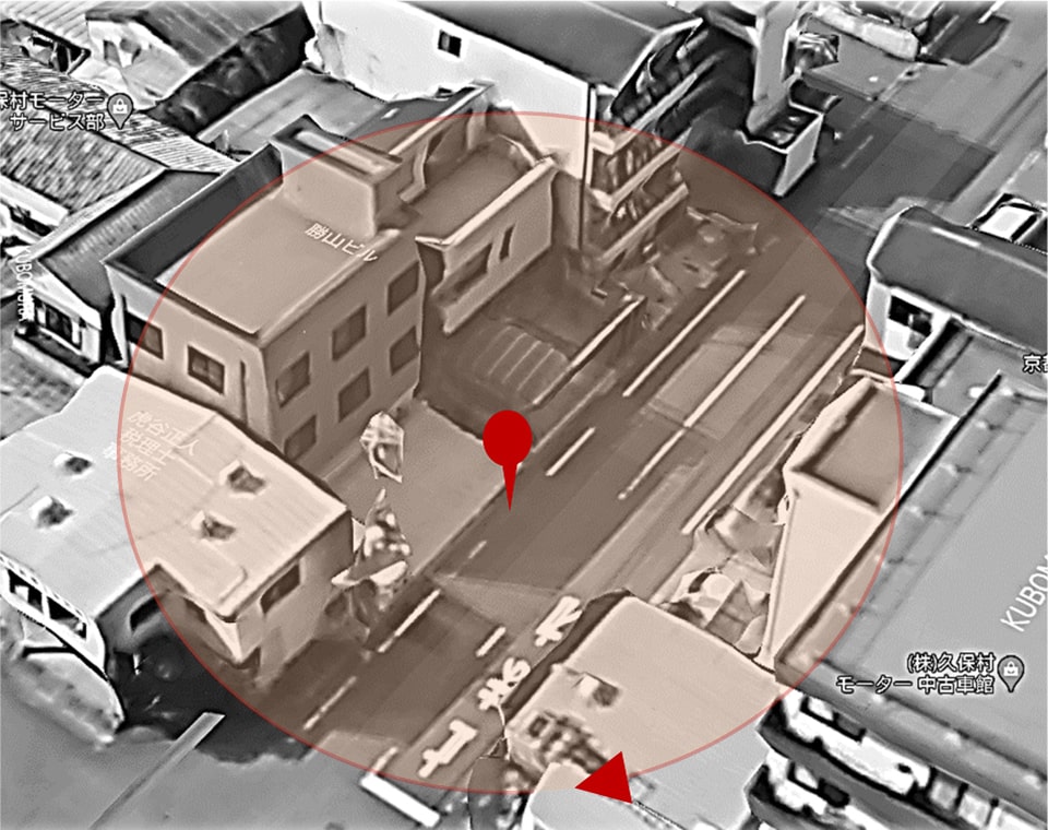
3D point cloud data is a collection of point data with 3D coordinates. By acquiring 3D point cloud data with a 3D laser scanner or other device capable of acquiring such data, it is possible to save the entire building or facility as a collection of points (3D point cloud data) in its original size. There are various ways to use this data, such as creating drawings for buildings for which no drawings remain, or preserving the current state of a building and leaving it as a record.
3D Laser Scanner
The entire building can be scanned and converted into data
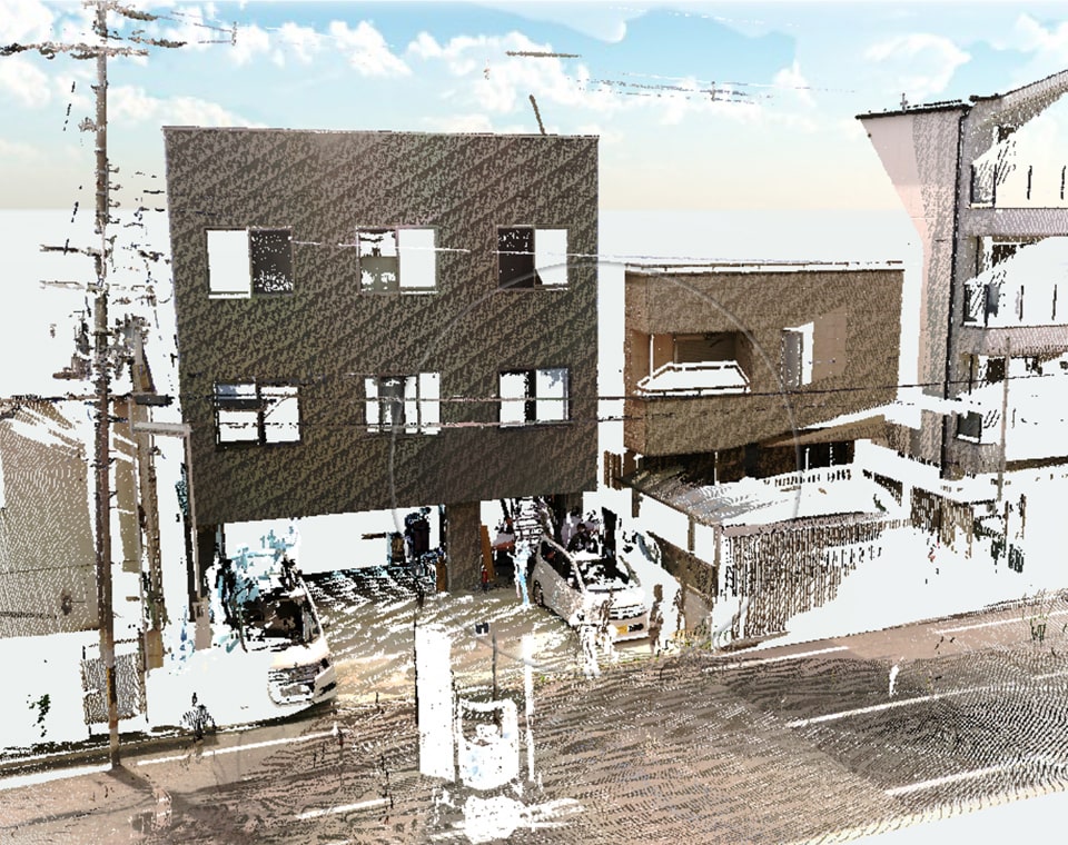
The 3D scanner can scan 360° from a location on the ground. The point cloud is created by scanning multiple times from multiple directions. In the example in the photo below, the point cloud data was completed by scanning three times for about 10 minutes.
Multiple scans performed
・Perform a multi-directional scan at the site.
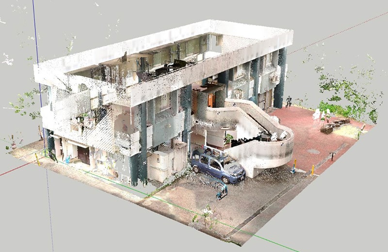
Point cloud created from 3D scan data
・The point cloud data is combined by software and converted to three dimensions.
2D and 3D data conversion from point cloud acquisition
By acquiring point cloud data, not only 3D data but also 2D data can be created. Thus, even if a building has no drawing data, it is possible to recover a drawing of the building from point cloud data acquisition.
1. Capturing images on site with a 3D scanner → Importing into point cloud processing software
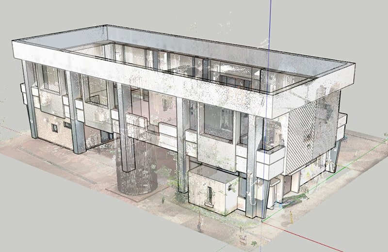
Local buildings were photographed with a FARO 3D scanner. The captured data is edited using the point cloud processing software “SCENE”. The point clouds are combined. The combined data is then imported into Sketchup, which can create 3D model data from the point cloud.。
2. Distance measurement from a point cloud and plotting for each surface
The distance is measured from the point cloud data imported into “Sketchup” and drawn for each face of the building. In Sketchup, the point cloud data is semi-transparent, and the watermark level can be changed, and the data can be displayed or hidden, making it easy to draw.
3. Export 3D data to DXF after drawing is complete
3D data completed in Sketchup can also be exported to DXF format, which is highly compatible with other software. (It can also be converted to AutoCAD's native DXF format for AutoCAD in AutoDesk.)
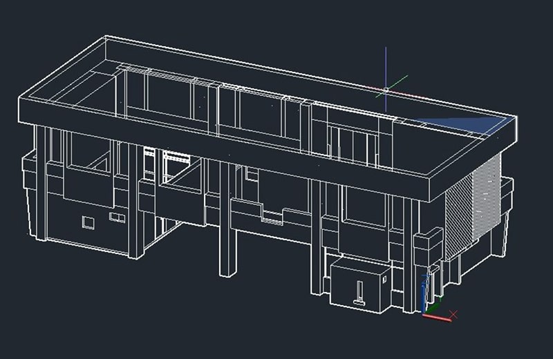
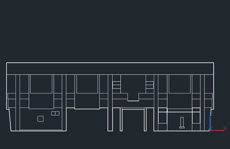
4. Parallel projection display and export
3D data converted to DXF format can be displayed in parallel projection and exported in 2D state. This flow can be used to restore drawings of buildings that do not have drawings.
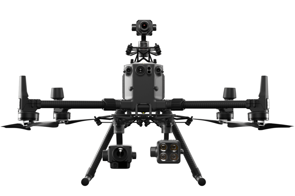
3D scanner and drone to create 3D data of structures
- 3D SCANNER -
FARO S350 + DJI MATRICE 300 RTK
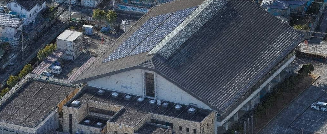
Although 3D scanners can record entire buildings in point cloud data, there are some structures, such as high-rise structures and rooftop surfaces of buildings, for which it is naturally difficult to acquire all the point cloud data by laser scanning from the ground alone. In such cases, using a drone in combination with a 3D scanner makes it possible to create a 3D image of the entire structure.
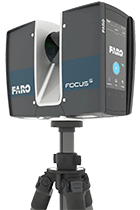
3D Scanner<FARO S350>
In addition to improving distance and angle accuracy and extending the measurement distance, the Focus scanner's on-site correction function ensures high-quality measurements. The Focus scanner's on-site correction function provides high quality measurements.
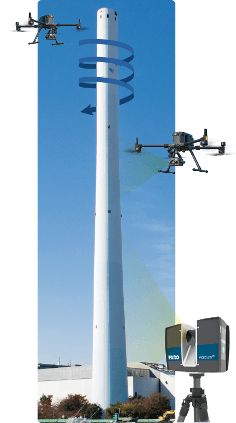
3Dization flow combining aerial photography and 3D scanning
- A 3D laser scanner is used to acquire 3D data including the absolute coordinates of the distant view of the structure.
- Aerial drone photography is used to take close-up images of the target structure to obtain high-resolution images.
- Simple 3D data is composed by superimposing multiple images acquired by aerial drone photography.
- Collation of 3D data from the drone and 3D laser scanner. Adds positional information from the 3D laser scan to the image data acquired by the drone.